In today’s rapidly changing world, information is everything, and almost everything has a spatial or locational component. Our GIS team can help you turn your geographic information into a valuable resource to be used as an everyday tool. We utilize ESRI’s ArcGIS desktop and mobile technology to provide an array of mapping, data management, and spatial analysis solutions. Land developers rely on our GIS modeling capabilities to help target their investments in turn helping to facilitate permitting activities. Government agencies depend on our GIS expertise to broaden their spatial data inventory and to implement creative ways to utilize and collect existing data. We also help enterprises design and implement GIS solutions that meet their objectives and also support these enterprises with targeted training and technical assistance. With future developments on the horizon like Indoor GIS, GPS/LiDAR mobile platform-based project scanning, and advanced subsurface utility engineering, we are in a position to bring these new technologies onboard based on practical needs and applications. At Johnson Engineering, GIS is integral to all our disciplines with increasing client-based GIS solutions – you can be next.
What We Provide
Starting your project headed in the proper direction is important, and that’s where our services utilizing LiDAR-derived products such as contour lines or TIN surfaces, can help. We use LiDAR-derived products to give you an initial glance of the feasibility of your site as well as layout a picture of what the development process might look like. Our techniques in analyses, visualization, and verification will help us set reasonable expectations about your project. With our experience, we can also coordinate 3rd party LiDAR data acquisition specific to your project, with a potential cost savings versus traditional survey topographic data collection. This is an alternate to expensive conventional survey topographic data collection for projects. Many of our local and regional areas are covered with LiDAR generated data.
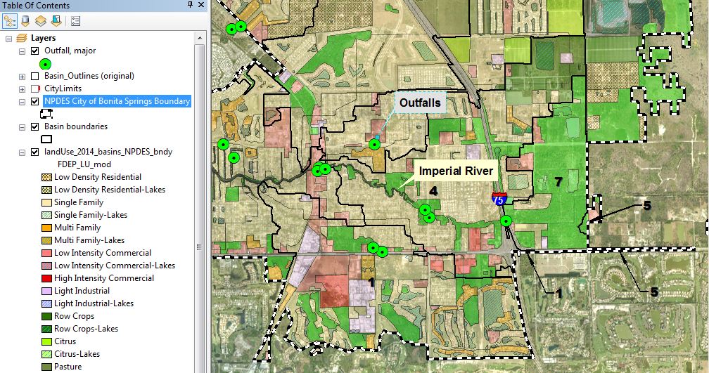
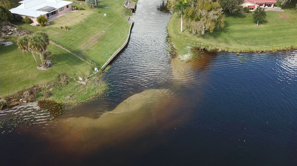
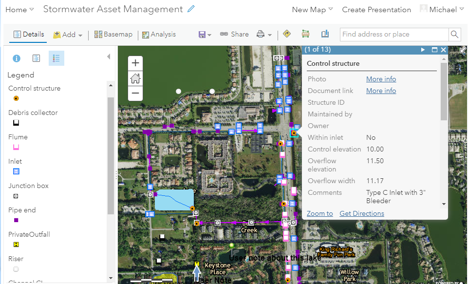
Thousands of stormwater features. Frequent maintenance issues. NPDES requirements. Concerns about contamination via spill incidents. What is a Public Works department to do?
These are all reasonable and common questions. A centralized, well-organized, and easily accessible GIS can satisfy these questions. We would like to help you:
- Convert your paper maps, CAD files, GIS files, and PDFs into a useful, well-documented GIS using industry-standard software.
- Make your Stormwater Infrastructure GIS accessible to your staff and management via a web browser and smartphone and simple web applications.
- Integrate with your existing operations.
- Integrate with other front-end asset management solutions such as CityWorks.
Take a look at our sample online map for a desktop web browser.
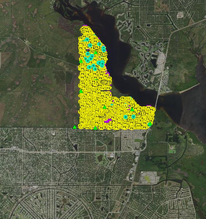
Which parcels must our CDD maintain? Where are the outfalls for our stormwater system?
When is exotics control due for that preserve? Where do we have fences, walls, or gates which we maintain?
We think these are all common questions for a CDD Board or management company. We can put the answers to these questions right at your fingertips when you need them. To begin the process, you need:
- Your existing data is cleaned and loaded into a thoughtfully-constructed geodatabase
- An online map so you can access your CDD stormwater and other infrastructure from any device with an internet connection
Take a look at a sample online map (desktop web browser).
Take a look at the same online map using the Explorer app (iPhone / Android devices only).
Hundreds to thousands of acres to manage. Lease areas, harvest areas, conservation areas, fences, gates, ditches, berms, pumps, and wells all scattered about. Employees traversing the lands carrying out their daily tasks, needing to have efficient access to helpful mapping data.
How can we keep this operation running well? This can be facilitated by a web-based mapping system that allows users to toggle your data layers on/off as needed, intelligent selectable features with pop-up data boxes, the ability to collect points/areas in the field and attach documents or photos to the collected features, all transmitting data via cellular connection for a surprisingly affordable cost. Layers depicted could include property boundaries, wetlands, wells, fuel tanks, or lease areas, to name a few. Specialty applications can be developed for things like wildlife surveys. The net result is a more efficient agricultural operation. Ask us where we are currently doing this.
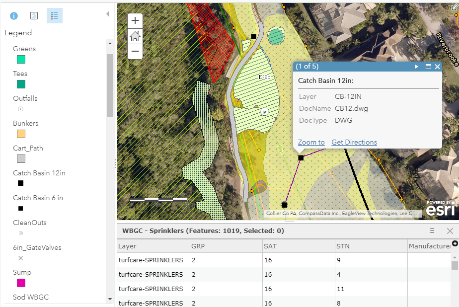
How can a golf course superintendent be knowledgeable about the course’s infrastructure when there are so many systems and components?
How can a maintenance crew efficiently respond to various daily requests?
A properly developed GIS along with an easily accessible 24/7/365 online mapping system can satisfy these needs. Knowing exactly where your facilities and sensitive areas are located and being able to quickly share that information out to staff can be a valuable tool in a well-managed golf course maintenance operation. Showing greens, bunkers, irrigation, drainage facilities along with preserve areas and property lines can save time and money in day to day operations. Individual features can be selectable and intelligent with photos attached and pop-up windows depicting key information. Your current location is shown on the map when using the mobile devices making it easy to navigate to any mapped feature.